
Remote Sensing 23 items
Content across the network sharing this tag, grouped by type.

USF IMaRS ERDDAP
USF's ERDDAP server for satellite ocean color (MODIS, VIIRS, Sentinel-3 OLCI, PACE), net primary productivity and precipitation products over the Gulf, Florida and the wider Atlantic.
Learn more
MarineSDMs
Materials and code for building marine species distribution models (SDMs) from open occurrence and environmental data.
Learn more
AquaMaps Downscaled
Downscaled AquaMaps modeled species distributions for finer-resolution marine biodiversity mapping.
Learn more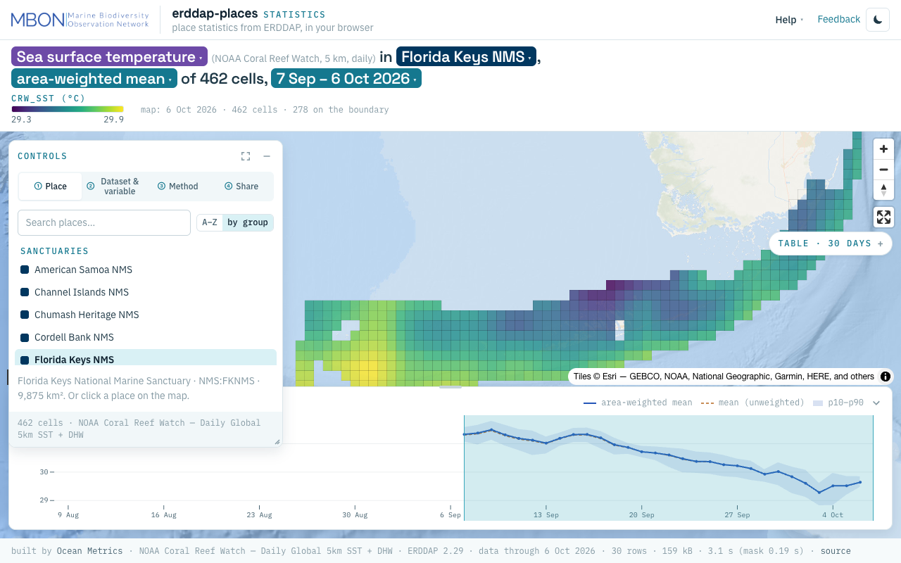
erddap-places
Place statistics from ERDDAP gridded and tabular data for sanctuaries and other marine places, computed in your browser, plus a Then vs Now lens for sanctuary sea surface temperature. The URL is the view.
Learn more
extractr
R package providing a common interface to extract and summarize gridded environmental data (ERDDAP, DataONE, and more) over a place.
Learn moreSeasonal changes in phytoplankton community of the Straits of Florida near the Florida Keys
Di Geronimo Sebastian et al. · Frontiers in Marine Science
Read paperOceanographic Indicators of Seasonal Variability in the Guajira Upwelling System and Their Relationship with Phytoplankton
Jhon Carlos Salon-Barros et al. · Oceans
Read paperMarine megafauna select pelagic habitats in a dynamic ocean
Ben D’Antonio et al. · Landscape Ecology
Read paperComparing Cloud Mask Products for Seagrass Mapping Over Sentinel‐2 Imagery: Toward a First National Seagrass Map for Venezuela
Chengfa Benjamin Lee et al. · Journal of Geophysical Research: Machine Learning and Computation
Read paperCloud-based satellite remote sensing for enhancing seagrass monitoring and ecosystem management
Luis Lizcano-Sandoval et al. · ISPRS Journal of Photogrammetry and Remote Sensing
Read paperClimate‐Driven Shift of Immature Albacore: Potential Habitat Alterations in the Indian Ocean
Sandipan Mondal et al. · Fisheries Oceanography
Read paperAn extreme North Atlantic Oscillation event drove the pelagic Sargassum tipping point
Julien Jouanno et al. · Communications Earth & Environment
Read paperDynamic Satellite Seascapes as a Biogeographic Framework for Understanding Phytoplankton Assemblages in the Florida Keys National Marine Sanctuary, United States
Enrique Montes et al. · Frontiers in Marine Science
Read paperThree decades of variability in California's giant kelp forests from the Landsat satellites
Tom W. Bell et al. · Remote Sensing of Environment
Read paperSea Surface Temperature Imagery Elucidates Spatiotemporal Nutrient Patterns for Offshore Kelp Aquaculture Siting in the Southern California Bight
Jordan N. Snyder et al. · Frontiers in Marine Science
Read paperSatellite sensor requirements for monitoring essential biodiversity variables of coastal ecosystems
Frank E. Muller-Karger et al. · Ecological Applications
Read paperPhytoplankton Pigment Communities Can be Modeled Using Unique Relationships With Spectral Absorption Signatures in a Dynamic Coastal Environment: MODELING PIGMENT COMMUNITIES
D. Catlett et al. · Journal of Geophysical Research: Oceans
Read paperDeep learning for all: managing and analyzing underwater and remote sensing imagery on the web using BisQue
Read paper
Satellite-Based Hurricane Damage Assessment
MBON, NERRS and NASA team develops automated, satellite-based method to evaluate damage caused by hurricanes and severe storms in coastal areas. Read more here. …
Read story
US and Global MBON Partnership: MBON Seascapes on NOAA CoastWatch
US and global MBON partnered with US IOOS, NOAA’s Oceanic and Atmospheric Research Atlantic Oceanographic and Meteorological Laboratory (AOML), and …
Read story
MBON and AOML Characterize Seascapes Biogeographic Regions to Understand Phytoplankton Assemblages in the Florida Keys National Marine Sanctuary
MBON, with NOAA/AOML, has characterized seascapes for the Florida Keys National Marine Sanctuary (FKNMS) and southwest Florida shelf nearshore environment using …
Read story