MBON Data Portal
Search, download, visualize, and analyze MBON data with the MBON Data Portal.


Products of data and software developed by MBON and partner programs. Use the filters to narrow by region, tool type, organization, or product type. To suggest an addition or correction, please open an issue.
Search, download, visualize, and analyze MBON data with the MBON Data Portal.
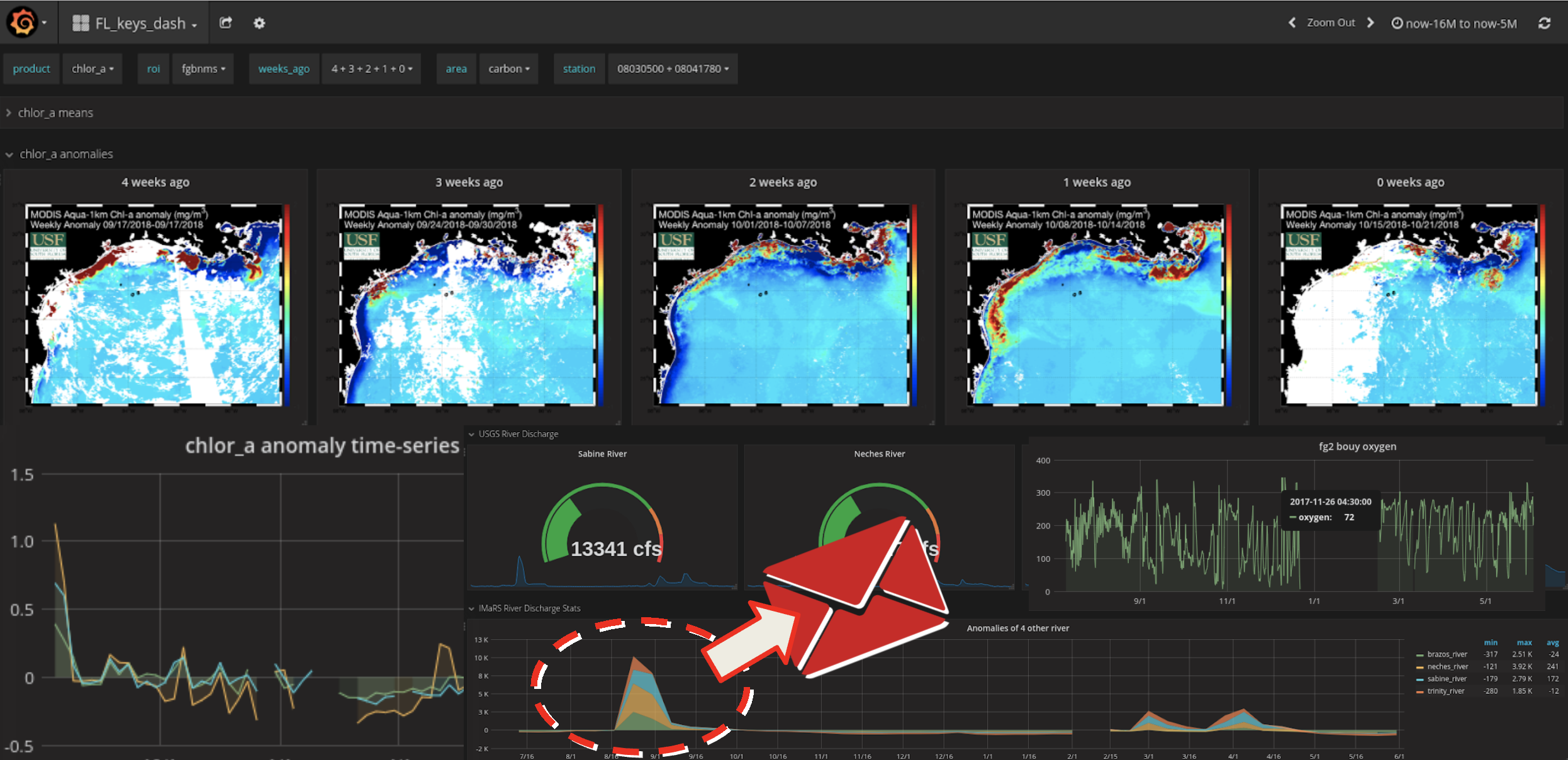
Early warning and alert dashboard of satellite and buoy data for detecting harmful algal blooms and anoxic conditions in the Florida Keys.
Docker software stack powering MBON's early-alert dashboards.
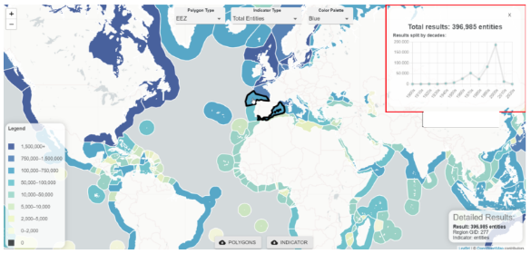
Extracting collocated satellite remote sensing products, gridded numerical model results, and field observations to create biodiversity indicators.
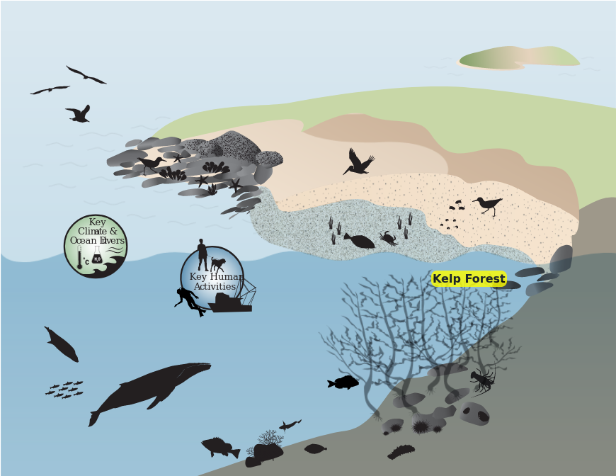
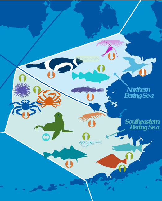
Interactive ecosystem infographics for Channel Islands National Marine Sanctuary.
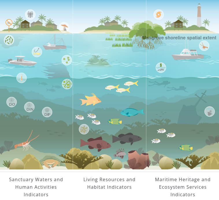
Conceptual diagram as interactive infographic for the Florida Keys Sanctuary associated with Ecosystem Status Report (ESR).
Through an integrated science approach, the NOAA Integrated Ecosystem Assessment program balances the needs of nature and society for current and future generations, supporting diverse marine resource management objectives in an ecosystem context.
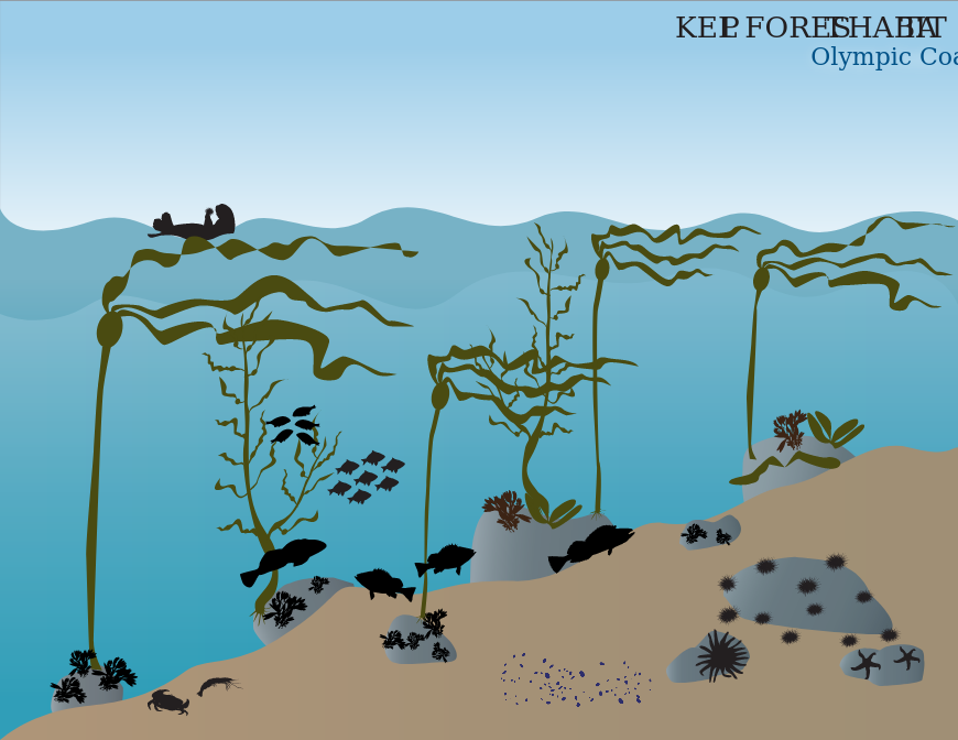
Interactive ecosystem infographics for the Olympic Coast National Marine Sanctuary.
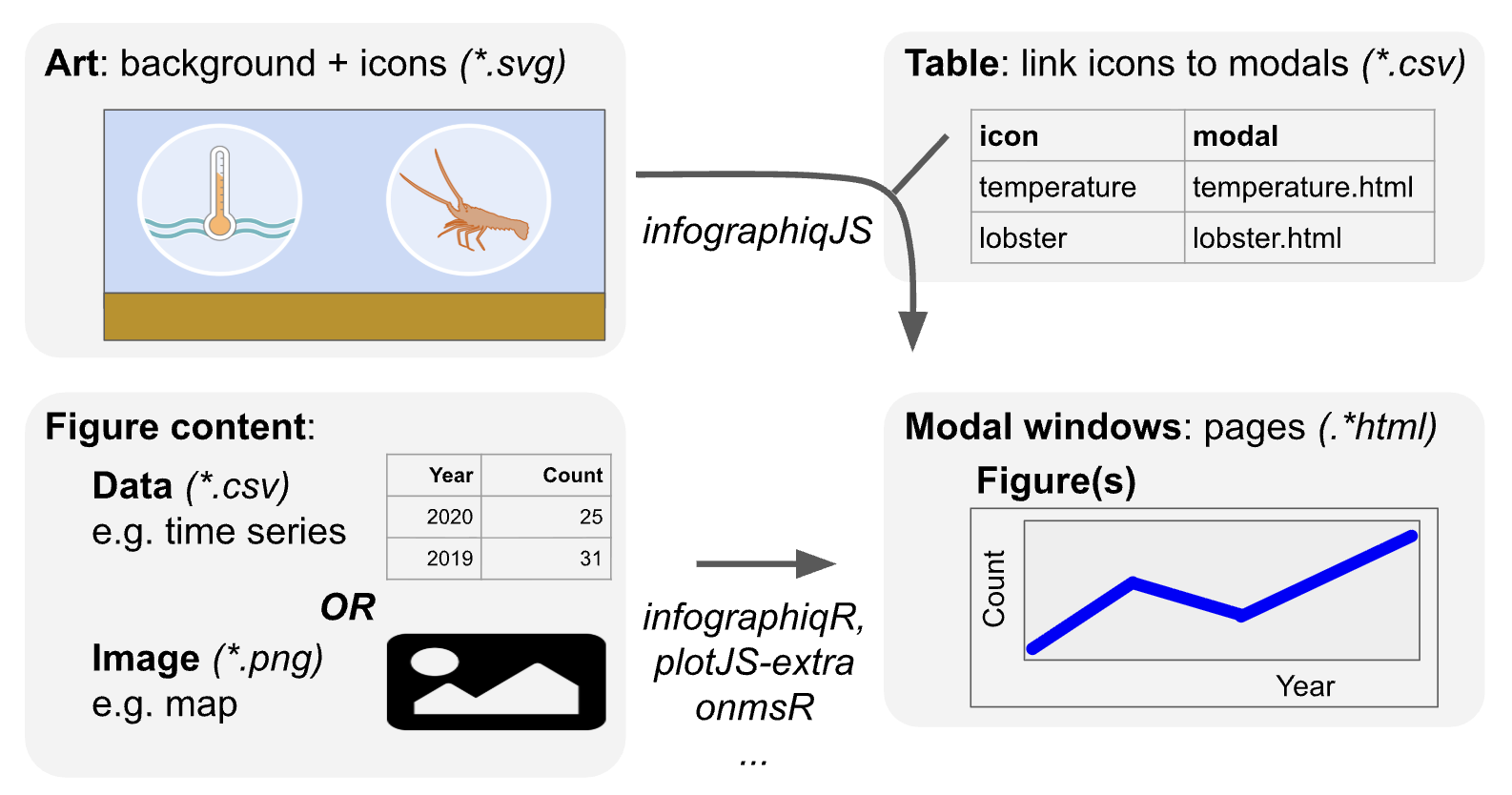
The Infographiq method uses a combination of JavaScript and R to produce clickable art that acts as an interface for users to access scientific data.
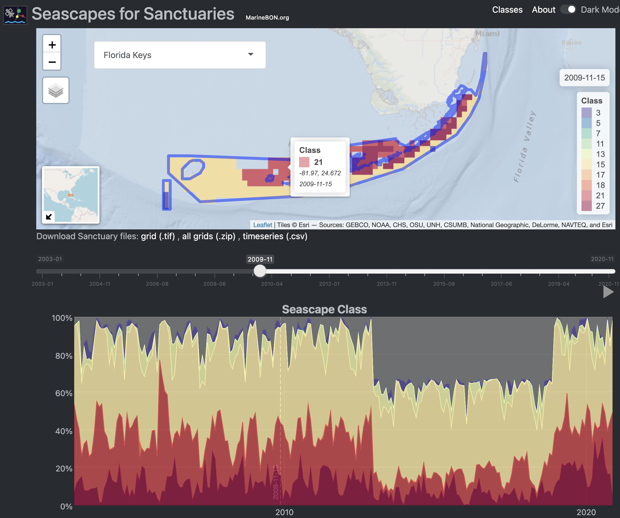
Shiny application to visualize global Seascape Classes in time and space for the National Marine Sanctuaries.
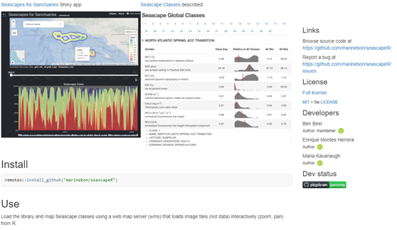
An R package and prototype interface to explore Seascapes in different marine regions, including US National Marine Sanctuaries.
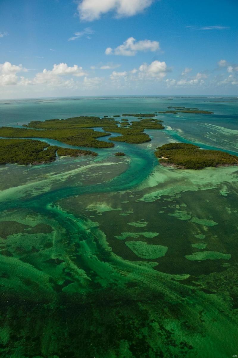
ArcGIS Story Map for water quality in the Florida Keys, developed by FWRI.

Web-based, interactive tools for tracking ecosystem conditions, human connections, and management impacts across National Marine Sanctuaries.
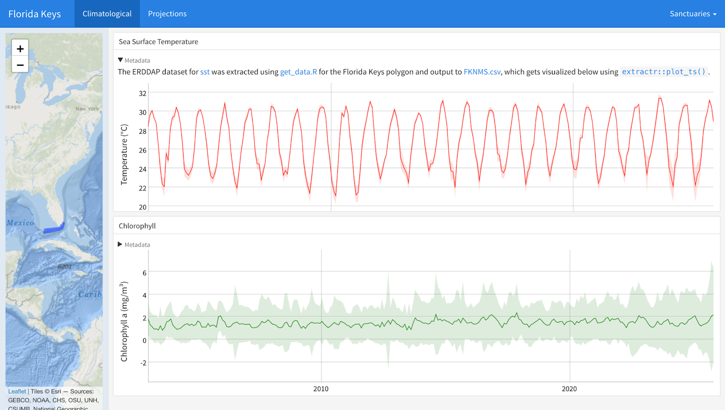
Static flexdashboard rendering climate indicators — sea surface temperature, chlorophyll-a, pH, sea-level rise — for each U.S. National Marine Sanctuary.
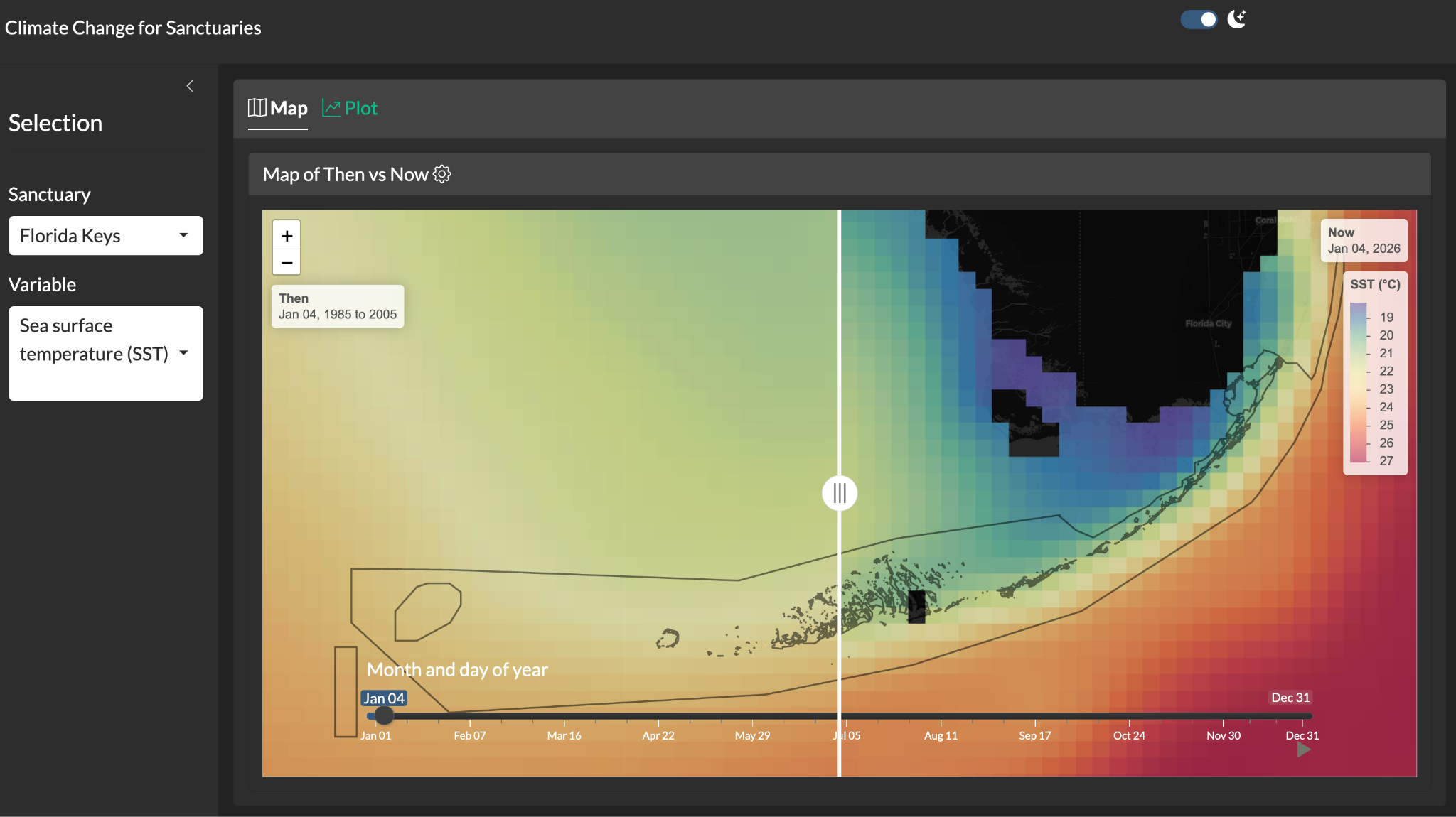
Shiny application with a swipeable "then vs. now" map comparing climatological reference periods to the present for each U.S. National Marine Sanctuary.
Report an issue with this website
Template by Bootstrapious. Ported to Hugo by DevCows.