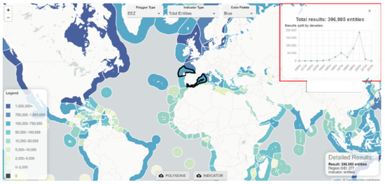
Extracting collocated satellite remote sensing products, gridded numerical model results, and field observations to create biodiversity indicators.
CoastWatch (J. Trinanes) is working on an approach for extracting collocated satellite remote sensing products, gridded numerical model results, and field observations such as from OBIS and NCEI, including Seascapes. The approach is to generate the products from the server side for individual or set of polygons.
React App (noaa.gov): https://cwcgom.aoml.noaa.gov/OBIS/